Seismic Community Responds to Virginia Earthquake in a Big Way

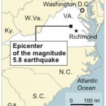
When the earth shook near Richmond, Virginia on August 23, 2011 at 1:51 PM EDT (17:51:04 UTC), millions of inhabitants of the eastern seaboard were surprised by the magnitude 5.8 tremor. The seismic community has responded in force, rapidly deploying dozens of new stations to record aftershocks of this rare event. (The largest previous earthquake in Virginia's history was a magnitude 5.9 event in 1897.)

This image, provided by the National Park Service, is one of three or four "significant" new cracks in the Washington Monument. The picture was taken from a Park Service helicopter. The Monument is being closed to the public indefinitely.
The United States Geological Survey (USGS) is participating in the aftershock effort with a major effort, coordinated through its National Earthquake Information Center (NEIC). The EarthScope/EPIC has deployed several dozen Intermediate-Period instruments and accelerometers as part of the cooperative effort. EPIC's Noel Barstow and Patrick Bastien have been in the field working with the aftershock deployment teams.

Building damage in Mineral, Virginia; photograph courtesy Francis Ashland, Research Geologist, U.S. Geological Survey.
The data from the initial event and subsequent aftershocks are already providing new insights into earthquakes in stable continental regions. Previous studies indicated that aftershock predictions in such stable regions could be made with generic California parameters, but the current sequence of aftershocks suggests this approach will need reconsideration.
The St. Louis University Earthquake Center has posted a map of aftershock monitoring stations.

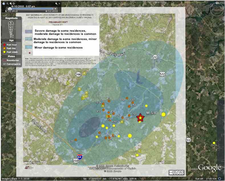
The map above displays "Relative Intensity Of Observed Damage To Residences From The August 23, 2011 Earthquake In Louisa County, Virginia," and is courtesy of Matthew Heller, Virginia Department of Mines, Minerals, and Energy; aftershock locations were determined and plotted by Bill Ellsworth and Jim Luetgert (USGS) and Ken Hudnut (Cal Tech), as of August 28th, 2011.

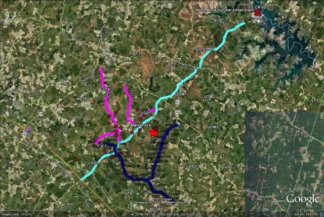
EPIC is providing over two hundred Texan digitizers to support measurements for a collaborative effort led by Larry Brown of Cornell. The first two of these deployments are shown in the map above in dark blue and cyan; proposed new lines appear in magenta.
The data from several stations are already being uploaded to the EarthScope DMC, under Station Code YC.
The research gems from this large collaborative effort are only just beginning to be put forward. Look for more important findings from these efforts in the very near future. EarthScope has provided several 'Teachable Moment' presentations and animations, available here.
- Home
- General Information
- Instrumentation
- Dataloggers
- Sensors
- All-In-One Systems
- Power Systems
- Field Procedures
- Controlled Sources
- Seismic Source Facility
- Magnetotelluric Systems at EPIC
- Ground Penetrating Radar
- GNSS/GPS Receivers
- Power and Memory Calculations Form
- Data Archiving
- Apply for a PI Account
- Experiment Scheduling
- Polar
- Hardware & Software Notes
- Software

