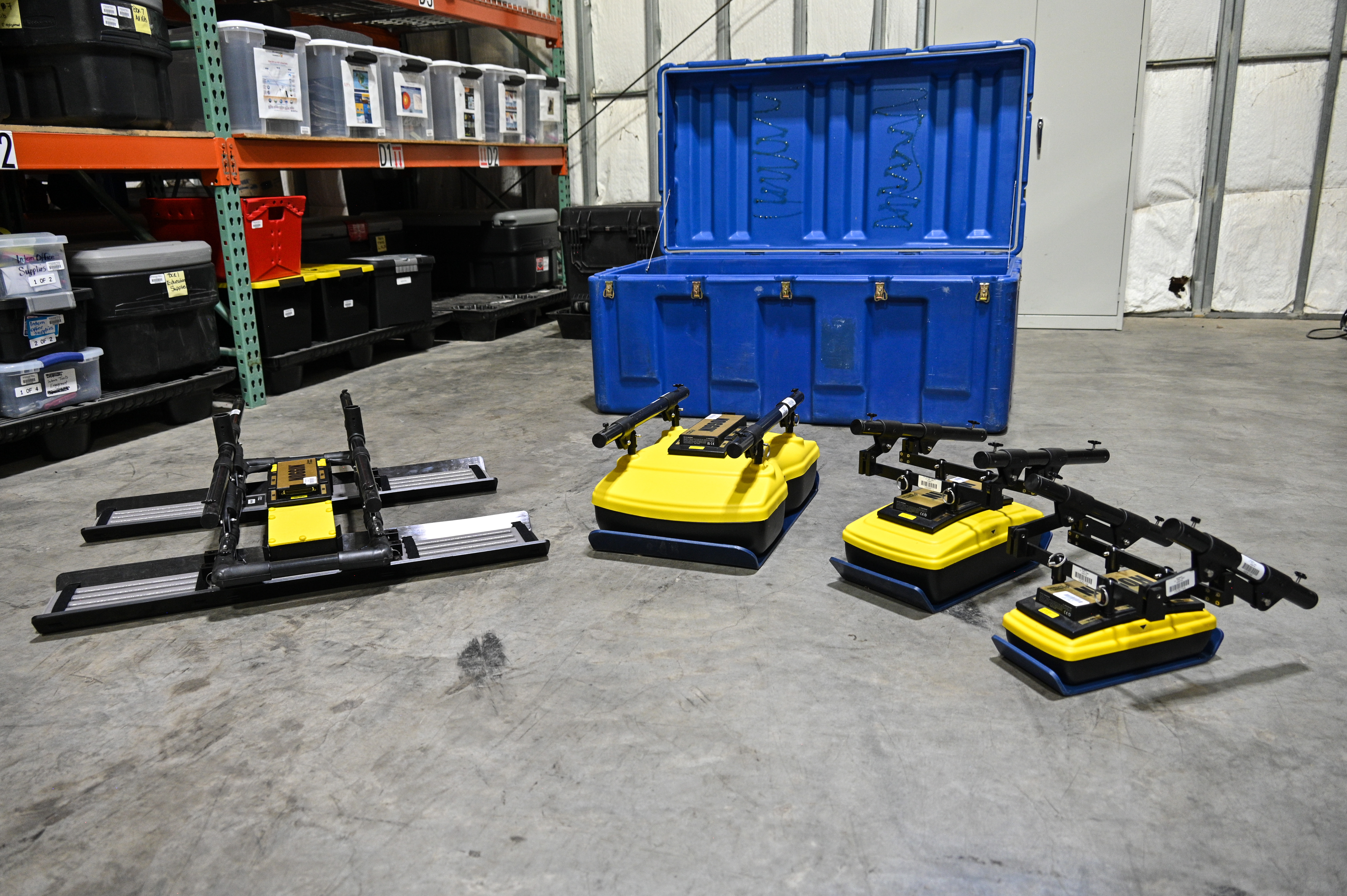
Ground Penetrating Radar (GPR) System

EPIC currently maintains a fleet of four Sensors & Software Noggin GPR Systems, each equipped with a SmartCart configuration (see image). These systems offer onboard GNSS/GPS positioning*, data acquisition programming, and preliminary data interpretation capabilities. Operators can perform both line-scan and grid-scan data collection, and the intuitive interface supports quick setup, real-time waveform viewing, and on-the-fly depth estimations. Each GPR system is now compatible with EPIC’s Emlid RTK GNSS equipment, enabling centimeter-level positioning accuracy for projects that require precise geolocation. Standard GNSS accuracy (several meters) is sufficient for many applications, but RTK corrections can be applied via a base station or cellular link—just ask EPIC staff for assistance or to reserve the appropriate accessories.
Processed onboard data can be visualized as depth versus position along a line, or as a slice view of grid data. For more in-depth post-acquisition processing and interpretation of the data, Sensors & Software EKKO Project GPR software access is also available from the EPIC.
The Noggin systems now support four frequency antenna configurations: 1000 MHz, 500 MHz, 250 MHz, and 100 MHz for near surface GPR investigations, expanding the bandwidth and allowing for tailored depth and resolution trade-offs across applications. The addition of the 100 MHz antenna significantly improves performance in environments where greater depth penetration is required.
1000 MHz: Highest resolution, shallowest depth—ideal for fine, near-surface detail
Example uses include hydrology, engineering, archaeology, forensics, and educational projects.
*Uncorrected GNSS/GPS locations have an accuracy of several meters, which is often sufficient for GPR surveying, depending on the use case. If you would like more accurate (cm-scale) GNSS/GPS locations, request an Emlid base station along with the receiver automatically included with the GPR. The base station will be able to send corrections to the GPR’s receiver. Or ask EPIC staff how to enable cellular corrections to the GPR’s receiver.
- Home
- General Information
- Instrumentation
- Dataloggers
- Sensors
- All-In-One Systems
- Power Systems
- Field Procedures
- Controlled Sources
- Seismic Source Facility
- Magnetotelluric Systems at EPIC
- Ground Penetrating Radar
- GNSS/GPS Receivers
- Power and Memory Calculations Form
- Data Archiving
- Apply for a PI Account
- Experiment Scheduling
- Polar
- Hardware & Software Notes
- Software


