
Emlid Reach RS2/2+/3 GNSS/GPS receivers
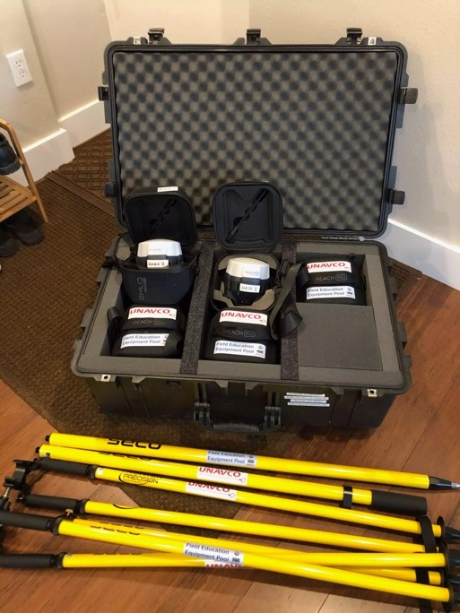 Emlid Reach RS2/2+/3 receivers enable georeferencing for a wide range of geoscience and geophysics applications. Survey points can be used to generate topographic data sets, to determine the position of other surveys (e.g., seismic nodal arrays, seismic refraction profiles, ground penetrating radar, electrical resistivity), or to record data collection points (e.g., sample locations).
For research purposes, the most typical use is two receivers – one configured as a base and one as a rover. To better enable teaching with GNSS, “educational kits” of five receivers (one base + four rovers) are also available (large classes can borrow more rovers, if available).