Deployment

A Deployment is when equipment and personnel take to the Field to obtain Data!

Sierra Negra Volcano, Galápagos Islands Deployment

In July and August of 2009, seven scientists deployed several seismic sensors for a two-year multidisciplinary study of one of the world's most active volcanoes, the Sierra Negra Volcano of the Galápagos Islands. The project's official name is “Collaborative Research: An integrated seismic-geodetic study of active magmatic processes at Sierra Negra volcano, Galápagos Islands.”

Related categories:

Batholiths Onland 2009

In July 2009, several EarthScope/EPIC scientists assisted with the Batholiths Onland project. This large group effort involved over 50 scientists and grad students, for the purpose of making "a seismic refraction and wide-angle reflection survey across the Coast Mountains batholith of British Columbia, Canada."

Related categories:

Batholiths Onland 2009 Photo Recap

In July 2009, several EarthScope/EPIC scientists assisted with the Batholiths Onland project. This large group effort involved over 50 scientists and grad students, for the purpose of making "a seismic refraction and wide-angle reflection survey across the Coast Mountains batholith of British Columbia, Canada."

Related categories:

Batholiths Experiment

The Batholiths experiment is a seismic refraction and wide-angle reflection survey across the Coast Mountains batholith of British Columbia, Canada. Several EPIC staff members will be deployed on the Batholiths Experiment in July of 2009. This project will involve over 2300 Texans and 1900 4.5Hz geophones in a combination of single-channel and three-channel station configurations, and will utilize two separate Field Centers.

Read more about the Batholiths Project at the Batholiths Website, and in a summary by PIs John Hole, George Spence and Kate Miller (810 kB).

A pair of photographic essays on Batholiths 2009 can be found here (short version) and here (long version).

Related categories:

Mt. Erebus Volcano Observatory (MEVO) Experiment 2008-2009

Brian Bonnett installs a MEVO station.

The EPIC Polar Program supported MEVO experiment was a seismic refraction experiment designed to image the magma chamber of the Mt. Erebus volcano in Antarctica. The Principle Investigators (PI's) and primary researchers involved with this experiment were Dr. Phillip Kyle, Dr. Richard Aster, Dr. Catherine Snelson, Dr. Daria Zandomeneghi and Hunter Knox. The project was funded through a grant awarded to the PI's by the National Science Foundation Office of Polar Programs. A paper that discusses this experiment has been published in EOS, Transactions, American Geophysical Union entitled: “Seismic Tomography of Erebus Volcano, Antarctica” authored by Zandomeneghi et al. (See the end of the article for details.)

Related categories:

POLENET

POLENET Project

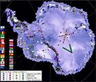
The Polar Earth Observing Network (POLENET) is a large international, multidisciplinary project which is a core activity of the International Polar Year (IPY) 2007-2009.  The project combines Seismic and GPS instrumentation at remote sites in Antarctica.  The data collected during the POLENET experiment will enable new studies of the inner earth, tectonic plates, climate, and weather.  U.S. POLENET projects are supported by the National Science Foundation. EPIC supports the U.S. seismic portion of POLENET by providing specialized cold-hardened, equipment, field support, and training for University based field teams.

Polar Project Sample Deployments

Here are articles on several recent Polar Project Deployments: Polenet Mevo

Guideline Documents


May 7, 2009


Here are links to documents that will help you to think about seismic station siting considerations and seismic vault construction during planning stages, field reconnaisance, and instrument deployment. Also included here are links to guidelines and procedures for station installation and station servicing.


Field Documents

Going to the field?

This section will help you get started with the basics on:

Huddle testing Station siting Seismic vaults Station installation Working with Responses to Get Units of Ground Motion
Related categories:

Station Service Procedure

Although EPIC station installations can vary according to the type of equipment being used, servicing is relatively straightforward and similar between station designs and equipment. 

Station servicing has 3 main goals:
• To retrieve waveform data recorded by the station since the previous service;
• To identify and rectify any problems with equipment or damage to the station;
• To refresh consumable items such as compact flash (CF) cards, batteries, etc.

A simple station with easy vehicular access should take around 20 man-minutes to service.

Syndicate content