Deployment

A Deployment is when equipment and personnel take to the Field to obtain Data!

Bighorn Arch Seismic Experiment: Results

In 2010, a group of seismologists deployed several hundred sensors across Wyoming and Montana as part of EarthScope's Bighorn Project and the Bighorn Arch Seismic Experiment (BASE). EarthScope/EPIC supplied instruments and expertise as part of this large effort, which included scientists from CIRES at University of Colorado Boulder(1), the Department of Geology at Colorado College(2), the Department of Geology and Geophysics at the University of Wyoming(3), and the Department of Geology and Geophysics at Texas A&M University(4). The Principal Investigators included Anne F. Sheehan(1), Megan L. Anderson(2), Eric A. Erslev(3), Kate C. Miller(4), and Christine S. Siddoway(2). William L. Yeck(1), the lead graduate student from UC Boulder, provided analysis and support included in this article. Additionally, numerous students contributed to the effort. The team's recent publication, "Structure of the Bighorn Mountain region, Wyoming, from teleseismic receiver function analysis: Implications for the kinematics of Laramide shortening," is available from AGU Publications (Full, PDF).

Related categories:

Transantarctic Mountains Deployments


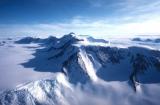
Audrey Huerta, Assistant Professor in the Department of Geological Sciences at Central Washington University, has graciously provided some videos of recent installations and deployments in the Transantarctic Mountains. They include footage of using a chain saw to deploy solar panels in the ice, a time lapse of a polar seismic system installation, and thermochronology sampling while rappelling.

(Photograph courtesy NSF)

Getting It Perfect at OIINK

Gary Pavlis and Terry Stigall of Indiana University are proud of their geophysics students. The students were helping them to deploy some new direct-burial stations with Trillium broadband sensors for the OIINK project (a.k.a. SDYNAC, "Structure and Dynamics of the North American Craton"), and Terry directed them to get them perfectly level and lined up to north accurately. The students outdid themselves, and helped to make this a superb installation.

These students are from Gary Pavlis' Applied Geophysics class. They spent a weekend installing stations for the OIINK project.

Clockwise from upper right: Tyler Merrell, Steven Downey, Crystal Wespestad, and Brenden Fenerty.

Photographs courtesy Terry Stigall.

Related categories:

Installing a "Cold and Dark" Seismic Station in the Yukon

On October 8-13, 2012, a three-man team from the EarthScope Transportable Array and EarthScope/EPIC installed a prototype "cold and dark" seismic station at Eagle Plains, Yukon Territory, Canada, just 30km south of the Arctic Circle.  The station installation developed new methodologies for drilling a shallow, 55" deep borehole in exposed bedrock. Protection for electronics, power, and communication subsystems (from the elements, and from large wildlife) was provided by an all-weather hut bolted to bedrock.

EPIC Intern Spends Summer on the Ice

EarthScope/EPIC summer intern Alan Shi has some interesting stories to tell about his last few months with the EPIC in Socorro, NM.  The season began calmly enough, and Alan enjoyed developing a testing enclosure to verify that field equipment boxes such as the MEVO (Mt. Erebus Volcanic Observatory) boxes were distributing power properly, as well as performing ruggedness-testing of memory sticks before their use to collect data in arctic regions. But, the most impressive part of Alan's summer by far was his deployment to the rapidly-changing ice sheets of Greenland.  Here are some recollections and photographs of intern Shi's experiences on the ice.


Mendenhall Glacier, Up Close and Personal

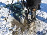
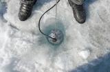
EarthScope/EPIC has been a key supporter of a novel deployment of equipment at Mendenhall Glacier in Alaska.  A team of researchers from the University of Alaska Southeast, the University of California Santa Cruz, and the Alaska Science Center in Anchorage have been performing an ambitious analysis as part of a low-budget cutting-edge project. Above, a Trillium Compact AT is lowered directly into a borehole in the glacier.

Related categories:

EarthScope Orientation Week Kick-starts a Busy Summer for Student Interns

For the last few years, several students have gathered at the EPIC (PIC) for the EarthScope Undergraduate Internship Orientation Week.  In the EarthScope Undergraduate Intern program, fifteen students fan out to conduct seismological research at thirteen
host institutions.  The program is organized and run by Michael Hubenthal of EarthScope.  This year, the staff for the week-long orientation program included Rick Aster (NMT), Greg Chavez (PIC), Kent Condie (NMT), Katie Foster (U. of Wyoming & Program Alumnus), Bruce Harrison (NMT), Michael Hubenthal (EarthScope), Hunter Knox (Sandia National Lab), Jesse Lawrence (Stanford University), William McIntosh  (NM Bureau of Geology), Sandra Saldaña (Noble Energy), John Taber (EarthScope), and Dave Thomas (PIC), along with Student Assistant Rob Anthony (NMT Grad Student & Program Alumnus).

Related categories:

EarthScope/EPIC Intern Cuts Her Teeth on TESGM Project Fieldwork

EarthScope/EPIC summer intern Jennifer Tarnowski is learning the ropes of a seismology career by working at the EPIC at New Mexico Tech, and also by participating with hands-on efforts in the field.  Jennifer recently participated in fieldwork supporting the Topographic Effects in Strong Ground Motion project (TESGM, EPIC project 201109) in early July, along with principal investigators Brady Cox,  University of Arkansas, Adrian Rodriguez-Marek, Virginia Tech., graduate student Clinton Wood, University of Arkansas, Robert Kent of the Network for Earthquake Engineering Simulation (NEES), and Steve Azevedo, EarthScope/EPIC.

EPIC supports Salton Seismic Imaging Project (SSIP)

Six EPIC staff members were in Southern California this March to support the Salton Seismic Imaging Project (SSIP).  The project is funded by NSF through both the MARGINS Program (now GeoPRISMS) and the EarthScope Program, and funded by the U. S. Geological Survey through the Multi-Hazards Demonstration Project. The project includes researchers from Virginia Tech, Caltech, the USGS, and Mexican partner institutions CICESE and UABC, Mexicali.

Related categories:

New Year, New Deployments!

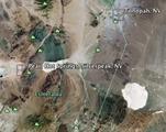
The EPIC is getting the New Year off to a bang with the Pearl Hot Springs active source experiment.  The Pearl Hot Springs experiment is a multidisciplinary study to explore the Basin and Range normal faulting in the area near Silverpeak, NV (see map). The Principal Investigator, Katie Keranen from the University of Oklahoma, along with her collaborators, Randy Keller, OU and Daniel Stockli, University of Kansas, planned Geologic mapping of the area, a Magnetic Survey, a GPS Survey and possibly a Ground Penetrating Radar survey to accompany the Seismic Study.  The PIC Texans and geophones were used for 2 active source seismic deployments within the Pearl Hot Springs experiment.

Related categories:
Syndicate content