USArray

TA Installation in Alaska Now Complete

After covering the lower 48 United States from coast to coast with a grid of nearly 1700 sites, the last seismic station of the EarthScope Transportable Array has finally been installed in Alaska. EarthScope has commemorated the event with a post titled "EarthScope’s Transportable Array Spans Alaska, the Last Frontier." The EarthScope article includes a detailed map of the Alaska TA stations, highlighting the location of the final station A19K. 

Flexible Array experiment researchers brave alligators in the name of seismology!


The alligator photographed guards SESAME's station E22.  Locals report the alligator likely made a short traverse through the forest from a nearby river, where alligators are commonly spotted, to call the pond home.

Transportable Array

Overview

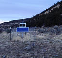
The Transportable Array (TA) is a gridwork of broadband seismic instruments that are being installed across the continental United States (see a map of TA stations that have been installed to date).  They are laid out in a rectangular array with approximately 75 kilometer spacing between stations stretching from Canada to Mexico and from the Pacific Ocean eastward.

Related categories:

USArray

The Flexible Array is a pool of portable seismic instruments supported by the Array Operations Facility at the EPIC. The instruments are available for PI-driven research projects associated with the goals of Earthscope. The pool consists of broadband (325), short-period (100), accelerometer (20), and controlled source (1700) stations. 

Syndicate content