Archived News

Here is a listing of PASSCAL News items from over 6 months ago. If you want to look up something newer, you should check Recent News.

Passing of Former EPIC Program Manager Jim Fowler

Jim Fowler passed away on February 25, 2014 after a lengthy battle with cancer and Parkinson’s disease. Jim began his career at EarthScope consortium (Incorporated Research Institutions for Seismology) in 1985 as Chief Engineer in Washington, DC, and later became the first manager for the EPIC portable instrument program. In 1999, after New Mexico Institute of Mining and Technology was selected to operate the EarthScope/EPIC, the nation’s sole lending library for research seismological instrumentation, Jim moved back to his home state of New Mexico. Jim stepped down as the EPIC Program Manager in October 2010 after 25 years in that position, but continued as Senior Advisor for Engineering and Instrumentation until he retired in February 2013 and moved back to Maryland.

Related categories:

Transantarctic Mountains Deployments


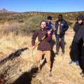
Audrey Huerta, Assistant Professor in the Department of Geological Sciences at Central Washington University, has graciously provided some videos of recent installations and deployments in the Transantarctic Mountains. They include footage of using a chain saw to deploy solar panels in the ice, a time lapse of a polar seismic system installation, and thermochronology sampling while rappelling.

(Photograph courtesy NSF)

Getting It Perfect at OIINK

Gary Pavlis and Terry Stigall of Indiana University are proud of their geophysics students. The students were helping them to deploy some new direct-burial stations with Trillium broadband sensors for the OIINK project (a.k.a. SDYNAC, "Structure and Dynamics of the North American Craton"), and Terry directed them to get them perfectly level and lined up to north accurately. The students outdid themselves, and helped to make this a superb installation.

These students are from Gary Pavlis' Applied Geophysics class. They spent a weekend installing stations for the OIINK project.

Clockwise from upper right: Tyler Merrell, Steven Downey, Crystal Wespestad, and Brenden Fenerty.

Photographs courtesy Terry Stigall.

Related categories:

RefTek GPS Alert


Dear EPIC Users:

This note is to alert all past and current users of RefTek RT130 hardware that these instruments have been experiencing GPS failures in-field. To date, the failures are geographically confined to East Africa and symptoms include intermittent or total loss of timing.

It is worth noting that in reviewing close to two years of repair records, 1303 GPS have been returned to PIC from 69 experiments, excluding those in East Africa, and the total number of GPS units that needed any type of maintenance or repair was 30. There is no evidence at this time that there is a global problem with our RefTek GPS.

We are recommending that all users of EPIC RefTek RT130 dataloggers review their data and log files for signs of GPS failure that are consistent with the failures seen in East Africa. To identify failure behavior please visit this page for a brief tutorial. If you identify failures in your data, please contact passcal [at] passcal [dot] nmt [dot] edu and include "RT130 GPS failure" in the subject line and unit serial numbers in the body of the email.

Related categories:

Education and Public Outreach at EPIC - French School Visit

On Friday, November 1st 2013, a group of students and teachers from Bethesda, Maryland's Lycée Rochambeau/ French International School visited the EarthScope/EPIC facility on Socorro NM for some hands-on demonstrations of how seismic measurements are used to "see" geological strata underground.  The class, led by instructor Marc Roux, head of the Biology and Geology Department, were assisted by EPIC scientists Greg Chavez and Michael Johnson during the deployment of a long string of geophones and a multi-channel data acquisition system.  The students then used heavy hammers to produce active source tremors, and then were able to see the seismic responses in real time.  The class assembled in the EPIC conference room to hear EPIC scientists/data specialists Dr. Wallis Hutton and KatyLiz Anderson discuss how such measurements can be used to find the depth of subsurface structures like the Moho.  The visit was capped with a tour of the EPIC facility, led by scientist/software engineer Dave Thomas. (Photo: student Salomé Carcy; credit: Dr. Wallis Hutton)

Related categories:
Syndicate content