Archived News

News stories from the PASSCAL archives

EarthScope Orientation Week Kick-starts a Busy Summer for Student Interns

For the last few years, several students have gathered at the EPIC (PIC) for the EarthScope Undergraduate Internship Orientation Week.  In the EarthScope Undergraduate Intern program, fifteen students fan out to conduct seismological research at thirteen
host institutions.  The program is organized and run by Michael Hubenthal of EarthScope.  This year, the staff for the week-long orientation program included Rick Aster (NMT), Greg Chavez (PIC), Kent Condie (NMT), Katie Foster (U. of Wyoming & Program Alumnus), Bruce Harrison (NMT), Michael Hubenthal (EarthScope), Hunter Knox (Sandia National Lab), Jesse Lawrence (Stanford University), William McIntosh  (NM Bureau of Geology), Sandra Saldaña (Noble Energy), John Taber (EarthScope), and Dave Thomas (PIC), along with Student Assistant Rob Anthony (NMT Grad Student & Program Alumnus).

Related categories:

Flexible Array experiment researchers brave alligators in the name of seismology!


The alligator photographed guards SESAME's station E22.  Locals report the alligator likely made a short traverse through the forest from a nearby river, where alligators are commonly spotted, to call the pond home.

EarthScope/EPIC Dedicates Seismometer Testing Observatory to Jim Fowler

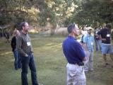
On March 28th, 2012, a beautiful Spring day, staff from the EarthScope/EPIC, Incorporated Research Institutions for Seismology (EarthScope), US Geological Survey, Sandia National Labs, and students assembled for the surprise dedication of the EarthScope/EPIC seismometer testing vault to Jim Fowler, founding Program Manager for EarthScope/EPIC (see "EarthScope/EPIC Celebrates Career of Jim Fowler", March 9th, 2012).

Before a large gathering of more than 75 people, Bob Woodward, EarthScope Director for Instrumentation Services emceed a series of speakers that included Rick Aster of NMT/EES and David Simpson, President of EarthScope.  David Simpson presented Jim's wife, Cynthia, with a bouquet of flowers in recognition for her contribution during Jim's 25 years of service.  Jim was then invited to the podium, where he thanked the staff of EarthScope/EPIC and EarthScope for "the easiest job he has ever had."

Related categories:

8th annual Polar Technology Conference coming to Vermont in April 2012

The 8th annual Polar Technology Conference will be hosted by EarthScope/EPIC on 3-5 April 2012 at the Lake Morey Resort in Fairlee, Vermont, USA.  Several staff members will be in attendance from both EarthScope (Robert Busby, Kent Anderson, and Katrin Hafner) and EarthScope/EPIC (Paul Carpenter, Jason Hebert, Allan Sauter).

The primary purpose of this conference is to bring together Polar Scientists and Technology Developers in a forum to exchange information on research system operational needs and technology solutions that have been successful in polar environments.  This exchange of knowledge helps to address issues of design, implementation, and deployment for systems that are to achieve their research goals in the Polar Regions.

Related categories:

EarthScope/EPIC Celebrates Career of Jim Fowler

Jim Fowler started as EarthScope Chief Engineer in 1984, and became the founding manager for the EPIC program.  In 1999, he relocated from Washington D.C. back to his home state of New Mexico, and set up an office in the EPIC.  As a news article from New Mexico Tech noted,

"My wife, Cynthia, and I are originally from New Mexico, so it really wasn't as difficult for us to move here as it might have been for someone who's a hardcore 'Easterner,'" Fowler says.

"Since most of my work involved the Instrument Center, it seemed best for all concerns if my office was actually located at the Instrument Center," Fowler points out. "Basically, instead of living in Washington and commuting to New Mexico, I now live in New Mexico and commute to Washington."

Related categories:

APOS Report Now Available Online

The report of the Autonomous Polar Observing Systems Workshop (APOS) has been posted online at EarthScope, and can be downloaded (2 MB PDF, 32 pages).  Several EarthScope and EPIC staff participated in this workshop and contributed to the report.

Related categories:

Western Idaho Shear Zone: is snow in the forecast?

FlexArray Experiment: Western Idaho Shear Zone

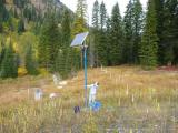
If this photo (below) of a 6' 1" tall individual looking up at the top of the solar panel mast doesn't cause one to wonder how much snow the mountains near Cornucopia, Oregon receive, a Snow Cat (below left) at a nearby lodge certain makes it's clear - lots of it. This temporary seismic station installed in the mountains of eastern Oregon is part of Dr. Ray Russo's Western Idaho Shear Zone Earthscope Flexible Array experiment. Spanning eastern Oregon to eastern Idaho, the seismic network covers arguably some of the most remote and rugged mountains of the contiguous United States.

AGAP Project Reveals Details of Hidden Antarctic Mountain Range


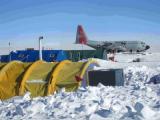
EPIC's Polar Group supported AGAP deployments in one of the most extreme polar environments on the planet.

Results are now emerging from the AGAP Project, funded by the National Science Foundation through its Office of Polar Programs. AGAP, which stands for Antarctica's Gamburtsev Province, has been probing the Gamburtsev mountain range for years. These mountains, completely covered by Antarctic ice, were not even discovered until 1958. New data now coming out are showing that these mountains have a youthful topography much like that of the Alps in Europe, and have not been weathered significantly.  Furthermore, the history of the root of the range can now be tracked back to one billion years in the past, with major rejuvenation events in the Permian and Cretaceous periods (~250 and 100 million years ago respectively). One reason the Gamburtsev range is important is that it is believed to be the initial site of Antarctic ice-sheet growth during major climatic changes some 35 million years ago.

Researchers Andy Nyblade of Penn State and Douglas Wiens and Patrick Shore of Washington University in St. Louis are part of the seismic portion of the project, called GamSeis. The EarthScope/EPIC provided an array of broadband seismic stations used for the project by Wiens and Shore, along with Penn State's Nyblade, and Masaki Kanao of the National Institute of Polar Research (NIPR).

Related categories:

EPIC's Polar Group Revs Up for Antarctic Summer

This is the time of year when the Polar group at EPIC is busy deploying teams to the Antarctic. Since polar conditions make for difficult site installations, EPIC is pleased to present the following instructive videos of Antarctic station deployments.

Courtesy of Audrey Huerta of Central Washington University, here is a time-lapse video of the difficult installation of a POLENET seismic system on a rock surface at Miller Ridge in the Transantarctic Mountains. This installation took about 4 hours in real-time. You will see shadows encroaching as the sun sets toward the end of the four-minute video.

Seismic Community Responds to Virginia Earthquake in a Big Way

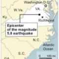
When the earth shook near Richmond, Virginia on August 23, 2011 at 1:51 PM EDT (17:51:04 UTC), millions of inhabitants of the eastern seaboard were surprised by the magnitude 5.8 tremor. The seismic community has responded in force, rapidly deploying dozens of new stations to record aftershocks of this rare event. (The largest previous earthquake in Virginia's history was a magnitude 5.9 event in 1897.)

This  image, provided by the National Park Service, is one of three or four "significant" new cracks in the Washington Monument. The picture was taken from a Park Service helicopter. The Monument is being closed to the public indefinitely.

Related categories:
Syndicate content