Polar Programs

EPIC's Polar Group Revs Up for Antarctic Summer

This is the time of year when the Polar group at EPIC is busy deploying teams to the Antarctic. Since polar conditions make for difficult site installations, EPIC is pleased to present the following instructive videos of Antarctic station deployments.

Courtesy of Audrey Huerta of Central Washington University, here is a time-lapse video of the difficult installation of a POLENET seismic system on a rock surface at Miller Ridge in the Transantarctic Mountains. This installation took about 4 hours in real-time. You will see shadows encroaching as the sun sets toward the end of the four-minute video.

7th annual Polar Technology Conference coming to Albuquerque in March 2011

The 7th annual Polar Technology Conference will be hosted by EarthScope/EPIC on 24-25 March 2011, at the Albuquerque Marriott, 2101 Louisiana Boulevard NE, Albuquerque, New Mexico 87110 USA. The primary purpose of this conference is to bring together Polar Scientists and Technology Developers in a forum to exchange information on research system operational needs and technology solutions that have been successful in polar environments.  This exchange of knowledge helps to address issues of design, implementation, and deployment for systems that are to achieve their research goals in the Polar Regions.

Related categories:

SEIS-UK joins EarthScope/EPIC on Support Effort for Antarctic Projects


SEIS-UK Director Dr. Alex Brisbourne accompanies the staff of the EPIC  to gain experience working in polar environments while supporting the POLENET and Whillans Ice Sheet projects for a month and a half during this year's field season.

Solar Panel Mounts Drawings

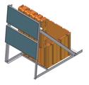
 Solar Panel Mount Drawings Angle Mount: 2x 80 Watt Solar Panels 7' x 4' x 6' 6" deployed 7' x 4' x 6" folded for transport 130 lbs complete Rock or snow deployment   Detailed Drawings Angle Mount rev C:  Assembly with BOM Rock Site Station


Insulated Sensor Vault Drawings

Vault Equipment Drawings Vault Double wall UV resistant polyethylene shell 2" thick indexed phenolic sensor base 3" thick polystyrene insulation Trillium 240 or Guralp T3 seismometers Detailed Drawings 3" Thick Insulation 2" Thick Indexed Phenolic Base Double Wall UV Resistant Polyethylene Shell

Station Enclosure Drawings

Station Enclosure Drawings   Large Enclosure:  Insulated Hardigg AL3434-2807 External dimensions:  37" x 37" x 37" Internal dimensions:  24" x 24" x 21" 2" thick vacuum insulation panel (VIP) sub-enclosure Protective polypropylene barrier between VIPs and electronics Integrated cable harness with external bulkhead connectors Year round operation with rechargeable AGM batteries   Detailed Drawings Hardigg AL3434-2807 Insulated:  Assembly Drawing with BOM

Polar Design Drawings

EPIC's strategy for designing cold-hardened seismic systems is driven by the need to maximize heat efficiency and minimize payload while maintaining continuous recording throughout the Polar winter. Our design is for a basic 2W autonomous system. Power is provided by a primary Lithium Thionyl Chloride battery pack and is backed by a secondary, solar charged AGM battery pack. Station enclosures are heavily insulated and rely on instrument generated heat to keep the dataloggers within operating specification. Although insulated, broadband sensors are operated close to ambient temperature.

Mt. Erebus Volcano Observatory (MEVO) Experiment 2008-2009

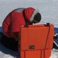
Brian Bonnett installs a MEVO station.

The EPIC Polar Program supported MEVO experiment was a seismic refraction experiment designed to image the magma chamber of the Mt. Erebus volcano in Antarctica. The Principle Investigators (PI's) and primary researchers involved with this experiment were Dr. Phillip Kyle, Dr. Richard Aster, Dr. Catherine Snelson, Dr. Daria Zandomeneghi and Hunter Knox. The project was funded through a grant awarded to the PI's by the National Science Foundation Office of Polar Programs. A paper that discusses this experiment has been published in EOS, Transactions, American Geophysical Union entitled: “Seismic Tomography of Erebus Volcano, Antarctica” authored by Zandomeneghi et al. (See the end of the article for details.)

Related categories:

POLENET

POLENET Project

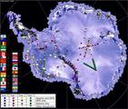
The Polar Earth Observing Network (POLENET) is a large international, multidisciplinary project which is a core activity of the International Polar Year (IPY) 2007-2009.  The project combines Seismic and GPS instrumentation at remote sites in Antarctica.  The data collected during the POLENET experiment will enable new studies of the inner earth, tectonic plates, climate, and weather.  U.S. POLENET projects are supported by the National Science Foundation. EPIC supports the U.S. seismic portion of POLENET by providing specialized cold-hardened, equipment, field support, and training for University based field teams.

Field Preparation Checklist for Polar Programs

This checklist is a list of items to consider while preparing for a new field project.  It is aimed at providing a list of things to think about while making preparations for and assessments of possible seismic sites. This checklist is also appropriate for the initial installations and for the removal of the equipment at the end of the project. These guidelines are fairly general but focused for polar regions.  It applies more to the Arctic and Sub-arctic regions rather than Antarctica, because for Antarctic projects, a lot of these issues are dealt with by the US Antarctic Program.


Site Assessment: Climatic conditions:Wind, snow, temperature, altitude, ... Access: On foot: conditions (all year, seasonal), roughness of terrain, safety, man power, ... By wheeled/tracked vehicle: conditions (all year, seasonal), roughness of terrain, ... By fixed wings aircraft: airstrip conditions (all year, seasonal), typical weather conditions,cost, availability, safety, permitting, ... By helicopter: landing zone conditions, typical weather conditions, cost, availability, safety, permitting, ... By boat:land base vs. ship base, ease of access to land, protection from storms, issues of accidental introductions of rats and other non-native species to protected islands, cost, availability, safety, ... Permitting (Public land, private land, restricted land, fees, monitored access, limited access to certain dates, etc). Type of ground: Rock, mud, snow, ice, vegetation, sand, gravel, etc. Hazards to the equipment: Wildlife: Bears (very destructive!), rodents, foxes, cows, etc. Humans: Theft, vandalism, etc. Hazards to crew personnel: Climatic conditions. Access (steepness of terrain, crevasses, isolation, volcanic area, etc). Wildlife (Bears, moose, etc). Humans (locals with guns, etc). Site Installation: Dates: Choice of dates to simplify logistics and installation. Take into account climatic conditions. Personnel, transport and equipment availability. Maximize data return. Minimize cost. Permitting: For land use. For access. For use of vehicle or aircrafts Transport: Personnel:customs issues, ... Equipment:customs issues, potential HazMat, ... Housing: Food: Contingencies:Things rarely all go as planned. Site Removal and Equipment Regrograde: Permitting:land reclamation requirements. Transport:Methods, customs issues, potential HazMat, scheduling. Returning equipment to EPIC:
Syndicate content