Here are some of the articles that have been recently posted to the PASSCAL website:

TA Installation in Alaska Now Complete

After covering the lower 48 United States from coast to coast with a grid of nearly 1700 sites, the last seismic station of the EarthScope Transportable Array has finally been installed in Alaska. EarthScope has commemorated the event with a post titled "EarthScope’s Transportable Array Spans Alaska, the Last Frontier." The EarthScope article includes a detailed map of the Alaska TA stations, highlighting the location of the final station A19K. 

EPIC Intern Winds Up Summer With "Ultrasound" of Mt. St. Helens

Federica Lanza, a Ph.D. student at Michigan Technological University under Gregory P. Waite, spent the summer as the EarthScope/EPIC intern. During that time, "Fede" deployed instruments with EarthScope interns, presented her work at the 2014 EarthScope workshop, and completed two research projects related to short period sensor responses and long period noise analysis using PSD PDFs. Fede wrapped up her summer with a couple of weeks in the field at Mt. St. Helens, supporting the iMUSH project, along with several other EarthScope/EPIC scientists and staff. Some highlights of our intern's busy summer follow.

Related categories:

AGAP Project Reveals Details of Hidden Antarctic Mountain Range


EPIC's Polar Group supported AGAP deployments in one of the most extreme polar environments on the planet.

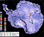
Results are now emerging from the AGAP Project, funded by the National Science Foundation through its Office of Polar Programs. AGAP, which stands for Antarctica's Gamburtsev Province, has been probing the Gamburtsev mountain range for years. These mountains, completely covered by Antarctic ice, were not even discovered until 1958. New data now coming out are showing that these mountains have a youthful topography much like that of the Alps in Europe, and have not been weathered significantly.  Furthermore, the history of the root of the range can now be tracked back to one billion years in the past, with major rejuvenation events in the Permian and Cretaceous periods (~250 and 100 million years ago respectively). One reason the Gamburtsev range is important is that it is believed to be the initial site of Antarctic ice-sheet growth during major climatic changes some 35 million years ago.

Researchers Andy Nyblade of Penn State and Douglas Wiens and Patrick Shore of Washington University in St. Louis are part of the seismic portion of the project, called GamSeis. The EarthScope/EPIC provided an array of broadband seismic stations used for the project by Wiens and Shore, along with Penn State's Nyblade, and Masaki Kanao of the National Institute of Polar Research (NIPR).

Related categories:

Documentation - How to Archive your Active Source Data

Refer to the documentations below to learn how to prepare the data you've collected for archiving.  EPIC supports PH5 and SEGY as the archival data formats of active-source data sets.

Data from PH5 format data sets archived at the DMC can be accessed via PH5 Web Services.

Related categories:

Transantarctic Mountains Deployments


Audrey Huerta, Assistant Professor in the Department of Geological Sciences at Central Washington University, has graciously provided some videos of recent installations and deployments in the Transantarctic Mountains. They include footage of using a chain saw to deploy solar panels in the ice, a time lapse of a polar seismic system installation, and thermochronology sampling while rappelling.

(Photograph courtesy NSF)

Seismic Community Responds to Virginia Earthquake in a Big Way

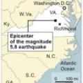
When the earth shook near Richmond, Virginia on August 23, 2011 at 1:51 PM EDT (17:51:04 UTC), millions of inhabitants of the eastern seaboard were surprised by the magnitude 5.8 tremor. The seismic community has responded in force, rapidly deploying dozens of new stations to record aftershocks of this rare event. (The largest previous earthquake in Virginia's history was a magnitude 5.9 event in 1897.)

This  image, provided by the National Park Service, is one of three or four "significant" new cracks in the Washington Monument. The picture was taken from a Park Service helicopter. The Monument is being closed to the public indefinitely.

Related categories:

Instrumentation

Instrumentation to support portable seismology available from the EPIC:

Dataloggers - This section encompasses the equipment which take in data and stores it on some type of non-volatile media.

Power Systems - All the required equipment to keep a seismic station continuously powered throughout its deployment.

Sensors - The equipment that actually detects and quantifies ground motion. The sensor sends this information to the datalogger through a cable.

Related categories:

POLENET

POLENET Project

The Polar Earth Observing Network (POLENET) is a large international, multidisciplinary project which is a core activity of the International Polar Year (IPY) 2007-2009.  The project combines Seismic and GPS instrumentation at remote sites in Antarctica.  The data collected during the POLENET experiment will enable new studies of the inner earth, tectonic plates, climate, and weather.  U.S. POLENET projects are supported by the National Science Foundation. EPIC supports the U.S. seismic portion of POLENET by providing specialized cold-hardened, equipment, field support, and training for University based field teams.

Frequently Asked Questions Regarding Data Requests from PH5 Data Sets

Here are frequently asked questions regarding data requests from PH5 data sets archived at the EarthScope DMC.  The answers are based upon the perspective the user is at the Data Request Form, which is available for each PH5 data set via its "Request" link found on the PH5 data set web page of the EarthScope DMC website.

1. How do I select the length of the record?

Related categories: